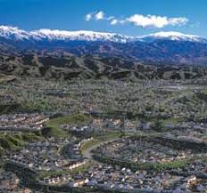
CANYON COUNTRY was the ancestral homeland of the Tataviam people for ov er five hundred years, and other tribes before then, such as the Tongva, Kitanemuk, and Serrano people. After the Spanish invasion the valley first became grazing lands of the Mission San Fernando Rey de Espana around 1790. In 1834, after Mexican Independence, it became part of the Rancho San Francisco land grant centered on the merging of the
 Santa Clara River
 er five hundred years, and other tribes before then, such as the Tongva, Kitanemuk, and Serrano people. After the Spanish invasion the valley first became grazing lands of the Mission San Fernando Rey de Espana around 1790. In 1834, after Mexican Independence, it became part of the Rancho San Francisco land grant centered on the merging of the
 In the 1880’s the rancho became the Newhall Ranch empire of Henry Newhall, now the present day Newhall Land Santa Clara River Newhall Land
VALENCIA was first planned in the 1960s by the
 Newhall Land Valencia
 was first planned in the 1960s by the
 NEWHALL
 is named after Henry Newhall, a businessman who made his original fortune during the California Gold Rush after opening up the H.M. Newhall & Company; an extremely successful auction house in
 SAUGUS is names after Saugus Massachusetts.
 In 1987 Saugus and three other communities - Newhall, Canyon Country, and Valencia - were combined and incorporated, becoming the city of Santa Clarita.
DEMOGRAPHICS
Historical populations | ||
Year | Pop. | %± |
110,642 | — | |
151,088 | 36.6% | |
2010(est) | 177,641 | 17.6% |
source: | ||
As of the census of 2000, there were 151,088 people, 50,787 households, and 38,242 families residing in the city. The population density was 1,219.6/km² (3,159.1/mi²). There were 52,442 housing units at an average density of 423.3/km² (1,096.5/mi²). The racial makeup of the city was 59.02% Non-Latino/Non-Hispanic White, 20.50% Hispanic or Latino of any race, 8.54% from other races 5.24% Asian, 3.89% from two or more races, 2.07% African America 0.59% Native American 0.15% Pacific Islander.
There were 50,787 households out of which 44.4% had children under the age of 18 living with them, 61.0% were married couples living together, 9.8% had a female householder with no husband present, and 24.7% were non-families. 18.7% of all households were made up of individuals and 6.1% had someone living alone who was 65 years of age or older. The average household size was 2.95 and the average family size was 3.38.
In the city the population was spread out with 30.3% under the age of 18, 8.1% from 18 to 24, 33.6% from 25 to 44, 20.8% from 45 to 64, and 7.1% who were 65 years of age or older. The median age was 33 years. For every 100 females there were 98.0 males. For every 100 females age 18 and over, there were 94.4 males.
According to a 2007 estimate, the median income for a household in the city was $79,004, and the median income for a family was $91,450 Males had a median income of $53,769 versus $36,835 for females. The per capita income for the city was $26,841. 6.4% of the population and 4.7% of families were below the poverty line 6.7% of those under the age of 18 and 5.9% of those 65 and older were living below the poverty line.
In 2000, the total population of Saugus
www.wikipedia.org/wiki/Santa_Clarita,_California
www.santa-clarita.com/
www.city-data.com/city/Santa-Clarita-California.html
www.wikipedia.org/wiki/Santa_Clarita,_California
www.santa-clarita.com/
www.city-data.com/city/Santa-Clarita-California.html
No comments:
Post a Comment