Sunday, November 28, 2010

Chapter 16: The North Pacific Coast

The North Pacific Coast is wet.  The greatest annual percipitation is 75 inches.  Heavy percipitation on the Olympic Peninsula supports rainforests where ferns and mosses grow in profusion and trees such as the western hemlock, red cedar, Sitka spruce, and the world's largest Douglas fir grow to heights of more than 60 meters (200 feet)" (page 324).

Santa Clarita is close to the Southern Pacific Coast and the climate is the exact opposite of the northern Pacific Coast.  The annual average precipitation in Santa Clarita is 17.96 Inches. Winter months tend to be wetter than summer months. The wettest month of the year is February with an average rainfall of 4.32 Inches.  Due to the low amounts of percipitation, Santa Clarita does not have rainforests. 


Santa Clarita has hot dry summers.  The warmest month of the year is August with an average maximum temperature of 95.40 degrees Fahrenheit, while the coldest month of the year is December with an average minimum temperature of 35.80 degrees Fahrenheit.

EARLY SETTLERS OF THE SANTA CLARITA VALLEY:


The Tataviam:
Early Newhall Residents.
By Paul Higgins, Environmental Educator.
Old Town Newhall Gazette, January-February 1996.
 

In AD 450, a small group of Shoshone-speaking people migrated to the Santa Clarita Valley. The Kitanemuk Indians, who lived in the Antelope Valley, called these people the Tataviam.
The name derived from their words taviyik, or "sunny hillside," and atavihukwa, or "he is sunning himself." Thus the word tataviam might be roughly translated as "people facing the sun" or "people of the south-facing slopes."
The Tataviam were more aggressive than the Chumash, who lived here at the time and encouraged them to move west down the Santa Clara River beyond Piru Creek. The Chumash referred to the Tataviam as "Allikliks." The Chumash word alliklik, thought by some to be a derogatory term, means people who stammer or do not speak clearly.
The Tataviam lived in approximately twenty various-sized villages within the upper reaches of the Santa Clara River drainage east of Piru Creek. Their territory extended over the Sawmill Mountains to the north and included the southwestern fringes of the Antelope Valley.
Some areas they occupied were Nuhubit (Newhall), Piru-U-Bit (Piru), Tochonanga — believed to have been located at the confluence of Wiley and Towsley Canyons — and the very large village of Chaguibit, the center of which is buried under the Rye Canyon exit of I-5.
The Tataviam also lived where Saugus, Agua Dulce and Lake Elizabeth are located today.


The typical Tataviam home consisted of a cone-shaped framework of willow poles covered with grass or other brush that was tied in place. The larger villages also contained gaming and dancing areas, cemeteries, granaries, work areas and sauna-like sweat houses used for cleaning and relaxation.
Southern California offered the Tataviam the most abundant natural food supply in North America. They lived without agriculture or domestic animals and developed a highly sophisticated system for exploiting the ecosystem.
Deer, rabbits, squirrels, birds, lizards, snakes, grasshoppers and caterpillars were hunted and trapped for food. Acorns, yucca, toyon berries, chia seeds and buckwheat were eaten regularly. Few if any nonagricultural peoples in the world were able to draw on so many food sources.
Life was good for the Tataviam. They were among the most ingenious, industrious and peaceful Indians of North America. They lived an honest life without laws, money, jails or a welfare system. They had no bad spirits, and before the missionaries came in 1769, they had no concept of hell or the devil. They did not change the land, but rather adapted themselves to it.


Any opportunity for collecting firsthand information about this obscure group of people vanished forever when the last full-blooded Tataviam, Juan José Fustero, died on June 30, 1921. Although much of the Tataviam culture has been washed away by floods or covered over by concrete, some still remains.
On May 2, 1884 a young man named McCoy Pyle discovered a cave in the hills above the present Chiquita Canyon Landfill, north of Highway 126. Inside he found many large woven baskets containing stone axe heads, obsidian knife blades, crystals, whistles made from deer bones, headdresses and capes made of iridescent condor and flicker feathers, and four ceremonial scepters consisting of painted stone discs attached to wooden handles.
Stephen Bowers purchased the entire collection for $1,500. Bowers sold the items to private collectors all over the world. Some of the "Bowers Cave" collection was sold to the Peabody Museum of American Ethnology at Harvard University, where it remains today. The fate of the rest is unknown.
Some small displays of Tataviam artifacts can be seen at the Placerita Canyon Nature Center, at the Saugus Station at Heritage Junction in downtown Newhall, at the Vista Del Lago visitors center at Pyramid Lake, and at the small museum at Ed Davis Park in Towsley Canyon.
Bedrock mortar areas, pictographs and middens can still be found in undeveloped areas of the valley. It is still common to discover stone points after rainstorms.
Who knows? Perhaps there is another large stash of Tataviam treasure still hidden in a cave somewhere in the Santa Clarita Valley, just waiting to be found!

http://www.scvleon.com/newhall/tataviam.htm

HIKING IN THE SANTA CLARITA VALLEY:


27201 Pico Canyon Road, Newhall, California, 91381
Santa Clarita Woodlands Park - Pico Canyon

Pico Canyon, located in the northern portion of the Santa Clarita Woodlands Park, is home to a rich and active oil history. Explore the remaining historic buildings of Mentryville, an oil boom town. Pico Canyon features large valley and coast live oaks, chaparral-dominated slopes, and views of Santa Clarita.
Santa Clarita Woodlands Park – Ed Davis Park at Towsley Canyon
24255 The Old Road, Newhall, California

Ed Davis Park in Towsley Canyon, named for former State Senator Ed Davis, who championed the preservation of Towsley Canyon, offers visitors a peaceful haven just west of the I-5 between the Santa Clarita and San Fernando Valleys. Trails for hiking, mountain biking, and equestrian use lead visitors through an astonishing variety of habitat types. Notable park features include spectacular water-worn rock formations in Towsley Gorge, year-round Towsley Creek, scenic trail viewpoints, and oak woodland.

Santa Clarita Woodlands Park - East Canyon, Rice Canyon, and Michael D. Antonovich Open Space
23801 The Old Road, Newhall, California

East and Rice Canyons are home to the Santa Clarita Woodlands' richest and lushest vegetation. The trailhead provides parking, restrooms, and picnic area.  A hike on the 3.8 East Canyon trail takes one through three species of oak.  California bay laurel, California black walnut, and bigleaf maple, up in elevation to a unusual forest of big cone Douglas fir.  The dirt fire road leads hikers, mountain bikers and equestrians on a steady climb to magnificent views of Santa Clarita Woodlands Park and the Santa Clarita Valley.  The trail leads into the over 400-acre Michael D. Antonovich Open Space which straddles the ridgeline of the Santa Susana Mountains.  Rice Canyon Loop Trail is an easy to moderate 1.2 mile trail along Rice Creek for hikers only.

These are maintained by Mountains Recreation and Conservation Authority, a subsidiary of the Santa Monica Mountains Conservancy.  Each provides a great look at plants and animals that thrive in our unique Mediterranean environment.

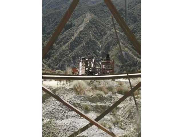
Towsley, in particular, affords unique possibilities.  It has burned twice in the last 10 years, giving us an opportunity to see how ecosystems come back from this type of “disaster”.  There is a small stream for a look at riparian communities, as well as very cool geological stuff.  This is the site of a natural oil field, and some of the oil still exists in pools you can spot along parts of the trails.  I recommend this particular hike for plant ecology, and birding. 

TREES:     


Urban Forestry

Santa Clarita is home to tens of thousands of native oaks which blanket our local mountains, line our streams and add a beautiful presence to our natural landscape. These native oak trees have a long history in Santa Clarita which date back to the 1800’s.


Urban Forestry maintains all of the City's street, park, trail, and facility trees, while planting many more each year. Trees enhance the quality of life in Santa Clarita by providing beautification and improving the air quality. The Division is responsible for the maintenance of 50,000 trees, reforestation, weed abatement, the Neighborhood Leaf Out Program, neighborhood plantings, the Arbor Day celebration, plancheck, review of plantings, and removal of trees. Contact Urban Forestry at (661) 294-2567.


General Information

Approved by the City Council in April 1989, the City of Santa Clarita ’s Oak Tree Ordinance (No. 89-10) is the mechanism by which the City of Santa Clarita draws its authority to regulate the pruning, encroachment, and removal of oak trees within the City of Santa Clarita . It serves as the backbone for all of the City’s policies regarding oak trees.
In September 1990, as directed by the Ordinance, the City Council passed the Oak Tree Preservation and Protection Guidelines. This document established the administrative procedures and rules for the implementation of the Ordinance.
As a matter of general practice, the City of Santa Clarita often revisits Ordinances as they age to ensure relevance and modern practices. The Oak Tree Ordinance and Preservation Guidelines are fifteen- and fourteen-years-old respectively. At the Joint Study Session of the City Council and Planning Commission on May 4, 2004 , City staff was directed to examine both documents in order to:
Streamline the Current Oak Tree Permit process.
  • Examine the distinction in the permit application process between individual residents and developers.
  • Examine the current fee structure associated with the Oak Tree Permit process.
  • Examine the development of an oak tree re-forestation program and tree tracking system.
  • Update any and all language and/or terminology in both documents that is no longer current.
  • Develop a public education strategy regarding the preservation and protection of oak trees.
Staff was also directed to receive input from the public regarding all of the items listed above. The purpose of this website is to provide information on the status of the process to revise the Ordinance as well as the Guidelines, and to provide an opportunity for members of the community to provide the City with their comments.


ECONOMY IN SANTA CLARITA:


BUSINESS ENVIRONMENT
Santa Clarita’s local economy is primarily a service based economy with 41% of the businesses in the service sector. An additional 21% of businesses are in retail trade and 10% each are in the finance, insurance, and real estate sector as well as construction.
The businesses located in Santa Clarita can be categorized as small businesses with 59% employing less than 5 employees. Businesses between 5 and 9 employees account for 19% of all businesses in the City and only 5% employ in excess of 50 employees.


WORKFORCE
Close to two in four or 38% of the workforce in the City of Santa Clarita is employed in the services sector. An additional 25% of the City’s workforce is employed in retail trade followed by 9% in manufacturing, 8% in construction, 7% in finance/insurance, and real estate industries, and 6% in wholesale trade.


More than one-fourth or 26% of the City of Santa Clarita’s workforce are in professional or specialized positions while another 21% are in administrative and support positions, 14% are in marketing or sales, and 11% are in executive roles.


One-third or 32% of Santa Clarita Valley’s manufacturing workforce is employed in aerospace with an additional 18% in computers and electronics and 14% in biomedical manufacturing. 


The City of Santa Clarita’s workforce in the services sector is somewhat evenly distributed among education at 16%, consumer at 15%, health at 14%, and entertainment/amusement and business/computer services at 13% each. The remaining 9% are employed in legal/membership/other services.


Based on an independent study of 367 communities across the United States by the Kosmont-Rose Institute, cost ratings were developed in order to compare difference communities based on business taxes, telephone taxes, sales taxes, property taxes, electric taxes, and state income taxes.
Santa Clarita is ranked as Low Cost ($$) compared to the Cities of Los Angeles and Pasadena which are both ranked as Very High Cost ($$$$$). Out of 224 California cities, Santa Clarita is ranked as the 11th lowest cost city in Los Angeles County.


http://www.santa-clarita.com/index.aspx?page=583


 FILMING IN SANTA CLARITA:


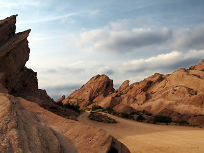
Santa Clarita's topography lent itself to early filming. Silent screen stars like William S. Hart and Tom Mix used the valley to create the traditions that would define the "Western."


SEE WHAT'S HAPPENING NOW IN SANTA CLARITA!


http://www.youtube.com/cityofsantaclarita#p/u/0/wsBRUItyQmU

Chapter 15: California

California has been my home for the last 50 years.  I lived in Hollywood, California for the first five years, fifteen years in the San Fernando Valley, eight years in Santa Monica, and now the last 22 years here in Santa Clarita, California.  Santa Clarita is my home sweet home.  I raised my children in Canyon Country due to a great educational system, affordable housing, employment, and lots of shopping.  Since I am so deeply rooted here, I imagine that I will continue to live here for many more years to come.  Santa Clarita is close to everything that I need. 

 PACIFIC OCEAN


 I love going to the ocean.  It is where I find my peace and tranquility.  I love Santa Monica and Malibu beach.  Now that my daughter goes to the University of California at Santa Barbara, I find myself traveling north on the 126 to the 101.  The trip requires a mandatory stop at Carpinteria Beach.  It is has become my new favorite beach.  It has tide pools filled with star fish, sea anemones, crab, lobster, birds, rocks, etc. etc. not to mention miles and miles of a great coastline. 
 Star Fish
 Sea Anemone

I love to walk.  It is my exercise of choice.  Santa Clarita has many paseos and hiking trails.  I love to go to Vasquez Rocks in Agua Dulce, California.  It is less than 10 miles north on the 14 freeway.

VASQUEZ ROCKS
10700 W. Escondido Canyon Road,
Agua Dulce


If you only have time to visit one wilderness area in Santa Clarita, this is where you should go. And if you live in the SCV, this is probably one of your favorite places.
 Vasquez Rocks

Why?

It is easy to access, and the spectacular rock formations are easy to climb and are a favorite to photograph. In the cool months (October - May), the rangers offer guided hikes and animal presentations.


And don't be surprised if you experience a little deja veux, because Vasquez Rocks has been the location of numerous television programs, music videos, and feature films--dating back to the silent film days.

SPECIAL EVENTS
Ranger-led hikes, power walk hikes, and animal presentations are offered in the cool months. Star parties, organized by The Local Group, offer visitors an opportunity to see the constellations. It's great fun! Check out the above link for exact times.

Please note: The weather can be completely different at Vasquez Rocks from the Santa Clarita Valley. Special events will be cancelled for inclement weather, so do call before heading to the park to avoid disappointment.

Birds of Prey Presentation
You'll get to see a couple of birds, a snake (if he's not in hibernation), and a rattlesnake skeleton. There's also a special display of...we'll let you be surprised. Meet at the park office. (This event is suspended during July, August & September due to extreme heat.)

Ranger Guided Hikes
The park ranger will lead a nature hike through the park. The hike will last approximately one hour. Meet at the park office. (This event is suspended during July, August & September due to extreme heat.)

http://www.santaclaritaguide.com/VasquezRocks


Placerita Canyon is another one of my favorite places to go on a nature hike.


Placerita is an east-west running canyon featuring cool, shaded oak groves, a willow and sycamore-lined seasonal stream and numerous other interesting plant and animal communities.
The historic "Oak of the Golden Dream" is the site of California's original gold discovery in 1842. Another landmark in Placerita is our Walker Cabin , built by Frank Walker in 1920 for his family.
A network of self-guiding nature, history and hiking trails radiates out into the park from the Center, with longer hikes leading to a seasonal waterfall and to the top of the Santa Clarita Divide. Picnicking is available near the Nature Center.
The park encompasses oak woodland, chaparral, and riparian plant communties on the north side of the San Gabriel Mountains southeast of the City of Santa Clarita. The park not only serves to conserve a slice of the wild environment but also endeavors to educate the public on the value of undisturbed flora and fauna through wild animal presentations, nature hikes, and self-guided educational trails.
Please feel free to contact the Nature Center at (661) 259-7721, between 9 am and 5 pm, Tuesday through Sunday (the office is closed on Mondays.)     
Placerita Canyon Natural Area is located at
19152 Placerita Canyon Rd, Newhall, CA, 91321
. Click here for a map and directions.

Placerita Programs

Every Saturday we offer a Family Nature Walk at 11AM and a Native Live Animal Presentation at 1PM. There is no charge for these programs and they are fun for the whole family.
Every second Saturday of the month there is a docent led Bird Walk starting at 9AM for beginning to advanced birders. Bring binoculars, a field guide, and water.
Every fourth Saturday of the month there is a "Blooms of the Season" wildflower walk from 9:30AM to 10:30AM. Click here for a program brochure.
In addition, The Placerita Canyon Natural Area docents lead a monthly Bird Walk at Castaic Lake Recreation Area on the first Saturday of the month at 8:00AM.    

http://www.placerita.org/


WATER SUPPLY
The company that supplies water to my home is: 
Santa Clarita Water Division
22722 Soledad Canyon Road
CA 91350-2945

History


Early 1900s
The growing valley towns are regularly faced with a fact of Santa Clara Valley life - it's picturesque creeks and rivers periodically flood. Unlike the tradition of the Ohlone natives, these permanent settlements cannot move to higher ground. Winter flooding begins to threaten valley homes, businesses and lives.

By the turn of the 20th century nearly 14,000 acres of orchards and vineyards are under irrigation in Santa Clara Valley. Wells are tapping into the underground aquifer at an ever-increasing rate, and for the first time local farmers notice a significant drop in water levels.

1920s As water levels drop, sections of the valley floor begin to sink. Concern over subsidence grows and in 1920 farmers and business leaders push for the formation of the Santa Clara Valley Water Conservation Committee. The committee hires noted engineer Fred H. Tibbetts of Campbell to study the situation and develop a plan. Tibbetts and his partner, Stephen Keiffer, recommend an ambitious project to construct a series of 17 large reservoirs to capture rainfall and begin the process of replenishing the underground aquifer through artificial recharge.

1930s
The Santa Clara Valley Water Conservation District, formed in 1929, begins construction on the district's first six reservoirs. In 1935, Calero, Almaden, Guadalupe, Vasona and Stevens Creek reservoirs are completed. Coyote Reservoir is completed in 1936. Recharging of the underground aquifers begins. The South Santa Clara Valley Water Conservation District is formed to build percolation facilities and manage creeks and groundwater in the area.
Flooding, however, is still a serious issue in the valley. Floods in 1931, 1937 and 1938 halt transportation and inundate hundreds of acres of orchards and pasture lands.

1940s The population in the county jumps from 30,000 in 1940 to 90,000 in 1948, then to 291,000 in 1950. This explosive post-war growth, combined with a major drought from 1940 - 1946, puts a severe strain on local water resources. Groundwater levels continue to drop due to increased agriculture, industry and residential construction, and land subsidence worsens due to overpumping. In response, voters pass bonds to construct two more large dams for water storage and percolation: Lexington and Anderson.

Ironically, in the midst of the drought and dropping water levels, heavy rains in 1940, 1942 and 1943 trigger devastating floods, causing power failures and leaving four dead in the Gilroy area.
The Central Santa Clara Valley Water Conservation District is formed to manage groundwater in the Morgan Hill region.


1950s

The valley is rapidly evolving from a predominantly agricultural area to an industrial and urban center. Accordingly, more of the county's water consumption shifts from agricultural to domestic and industrial use.

The South Santa Clara Valley Water Conservation District builds the Chesbro and Uvas dams to increase storage and recharge efforts. The Central Santa Clara Valley Water Conservation District is annexed to the Santa Clara Valley Water Conservation District. Water conservation education efforts begin in earnest.

In 1952 the county board of supervisors forms the Santa Clara County Flood Control and Water Conservation District. Its goals are to protect the county from flooding and supplement local water supply with water imported from outside the valley. The "Christmas Week" floods of 1955 leave thousands homeless. The Guadalupe River alone floods 8,300 acres, the worst flood on that river in recorded history.

1960s

The county's population swells to 642,000 by 1960.
President John F. Kennedy and Gov. Edmund G. "Pat" Brown join in a dedication ceremony in 1962 for the San Luis Dam and Reservoir west of Los Baños. The dam takes five years to build, and by 1987 is the source for imported federal Central Valley Project water to Santa Clara Valley through the Pacheco tunnel.

In 1965 the state of California begins delivering water to Santa Clara County via the 72-inch South Bay Aqueduct, which brings water about 40 miles from the Sacramento-San Joaquin River Delta to the county.

The valley's first treatment facility, the Rinconada Water Treatment Plant, begins operation in Los Gatos.

In 1968 the Santa Clara Valley Water Conservation District and the Santa Clara County Flood Control and Water Conservation District merge, forming one agency to manage the water supply and flood programs for most of the county.

By 1969 the addition of imported water to the local recharge efforts halts more than 40 years of land subsidence.

1970s

The Santa Clara Valley Flood Control and Water District changes its name to the Santa Clara Valley Water District.

The county's second treatment plant, Penitencia, located in the east foothills north of Penitencia Creek, comes on line.

Historic drought years in 1976 and 1977 reduce deliveries from the State Water Project, and the delta water it does provide is too full of salt to be percolated into local aquifers. The district's water conservation education program is established, and includes a school outreach component.

Conservation efforts achieve a 22 percent drop in water usage between 1976 and 1977.

1980s

The requirement to mitigate environmental impacts becomes a normal part of every construction project. The district hires biologists and environmental specialists who help ensure compliance with a myriad of environmental regulations. Water quality protection is a major focus as it is discovered that underground storage tanks are leaking and potentially contaminating drinking water. The third district treatment facility, the Santa Teresa Water Treatment Plant, begins operation.

Severe flooding in 1982, 1983 and 1986 heightens public interest in flood management projects. Funding for much needed projects is obtained through voter-approved benefit assessments and water utility revenue bonds.

The South Santa Clara Valley Water Conservation District is renamed the Gavilan Water District in 1980, and upon south county voter approval is annexed to the Santa Clara Valley Water District in 1987.

The federal Central Valley Project, San Felipe Division, begins delivery of imported water to the county in 1987. The water arrives just as the valley enters a seven-year drought period.

1990s

The prolonged drought results in a stepped-up district effort to seek new sources of water supply through recycled water projects, the storage of excess water in other regions (called water banking) and an aggressive water conservation program.

Flooding in San Jose in 1995 highlights the need to complete flood protection projects, especially on the Guadalupe River through downtown San Jose.

In 1996 the district initiates a long-term water supply planning process, the Integrated Water Resources Plan (IWRP). Projections indicate future severe droughts could result in a significant water supply shortfall-up to 100,000 acre-feet. To address this gap, the district, with help from IWRP stakeholders, selects four main water supply components: water conservation, water recycling, water banking and long-term water transfers.

The district embarks on a multi-year project to upgrade all three water treatment plants in order to continue to meet all state and federal water quality standards. The upgrades include changing the primary disinfectant to ozone, increasing the treatment capacity at Rinconada Water Treatment Plant and performing seismic upgrades.

Changing community priorities, more stringent state and federal regulations and an evolving environmental ethic lead the district into the 21st Century. The district's role as steward of the local watersheds is the driving force behind its mission: a healthy, safe and enhanced quality of living in Santa Clara County through the comprehensive management of water resources in a practical, cost-effective and environmentally sensitive manner.

2000 - 2009
The District takes a lead role in the fight against MTBE water contamination, addresses perchlorate contamination of more than 1000 South County well and partners with local wastewater agencies to increase recycling. The first phase of the WTIP is completed and the second phase launched.
2000: County voters endorse the Clean, Safe Creeks and Natural Flood Protection Plan (Measure B) and approve a special tax to ensure continuity of flood protection and stream stewardship services for 15 more years.
2002: A new 10-year Stream Maintenance Permit reflects an era of partnership between the district and resource agencies, and allows the district timely seasonal access to creeks for improved maintenance and environmental enhancement.
2005: The 15-year, $346 million Downtown Guadalupe Flood Protection Project is completed, protecting an estimated 95,000 people from flooding and restoring critical endangered species habitat.
2006: Santa Teresa Water Treatment Plant delivers the district’s first ozonated water, providing customers better-tasting, more healthful tap water.
2007: Assembly Bill 2435 passes, ending county oversight of the district’s budget and other procedural holdovers from the 1968 merger. Penitencia Water Treatment Plant begins delivering ozonated water to customers.
2008: The district achieves registration with the International Standards Organization (ISO), signifying consistency and excellence in its business and operations.
2009: District Board calls for 15% mandatory conservation in response to continuing water shortage; recession drives significant District budget reductions.
http://www.valleywater.org/About/History


In October of 2007, fires devastated the Santa Clarita area.  Fires are a common environmental threat when warm, dry winds (known as Santa Ana winds) blow from the interior of the state.  (see page 299)


Santa Clarita, CA Weather


Santa Clarita, CA climate is warm during summer when temperatures tend to be in the 70's and cool during winter when temperatures tend to be in the 50's.
The warmest month of the year is August with an average maximum temperature of 95.40 degrees Fahrenheit, while the coldest month of the year is December with an average minimum temperature of 35.80 degrees Fahrenheit.
Temperature variations between night and day tend to be big during summer with a difference that can reach 40 degrees Fahrenheit, and moderate during winter with an average difference of 28 degrees Fahrenheit.
The annual average precipitation at Santa Clarita is 17.96 Inches. Winter months tend to be wetter than summer months. The wettest month of the year is February with an average rainfall of 4.32 Inches.
http://www.idcide.com/weather/ca/santa-clarita.htm

10 Things You Should Know Before Moving To Santa Clarita


Santa Clarita is a wonderful place to live, and this list of “10 Things” certainly does not define this city.  Because of Santa Clarita’s location, independence, and diversity, there could easily be dozens of lists of “10 Things…”.

1) Santa Clarita is not Los Angeles
Santa Clarita is an independent city located 35 miles north of downtown Los Angeles.  Incorporated in 1987, it’s the fourth largest city in Los Angeles County.  We enjoy our own secluded community, but we are close to L.A. for much more shopping, entertainment, dining, etc.

2) Family oriented –
There are a TON of things to do in Santa Clarita for children and their families which include over 60 miles of walking paseos, beautiful parks, recreation, and activities.  Go-karts, martial arts, ice hockey, swimming, gymnastics, and much more are available to kids.  The City of Santa Clarita’s Skatepark and Aquatic Center attracts visitors from far outside the city.

3) Freeway traffic –
Traffic is a reality anywhere in Southern California.  Santa Clarita is bordered on the west by Interstate 5 and to the south and east by State Highway 14.  Getting in and out of the Santa Clarita Valley can test one’s patience when traffic levels are high.  Interstate 5 carries many commuters and commercial traffic down to Los Angeles and up to Northern California.  Highway 14 suffers from the typical rush hour traffic as commuters from Palmdale and Lancaster travel into Los Angeles for work each day.

4) Weather –
Santa Clarita is located within a valley along the foothills of the Angeles National Forest.  While Spring a Fall are mild, summers can get hot – reaching over 100 degrees, and winter can get cold – falling below the freezing level.  On a rare occasion, it can snow.

5) Safety –
Santa Clarita consistently ranks as one of the safest cities in America to live.  The Los Angeles County Sheriff patrols the Santa Clarita Valley, and neighbors all keep an eye out for one another.

6) Great schools –
Bottom line, the public schools in Santa Clarita are excellent.  There are two elementary school districts (Newhall School District and Saugus Union School District) and one high school district (William S. Hart Union School District).  The quality education that is offered adds to the appeal of this great city and the families that live here.

7) Beautiful natural scenery –
Santa Clarita is a suburb, but it is surrounded by mountains, National Forests, and nature.  This mix of open space with thoughtful development has provided a city with beautiful natural scenery everywhere.  Canyons, creeks, mountain vistas, lakes, and city lights at night make living in Santa Clarita refreshing.

8 ) Ethnically diverse –
Being in the middle of suburbia, people have the misconception that Santa Clarita has no ethnic diversity.  This couldn’t be further from the truth.  More and more people are relocating to Santa Clarita from parts of Los Angeles and the San Fernando Valley as well as from out-of-state.  Most of these people are attracted to Santa Clarita because of many features on this list.

9) Air quality –
We had originally made an error regarding this air quality paragraph.  We made the claim that Santa Clarita had good air quality.  We had no intention of being dishonest, but we had made that claim based upon our experiences in the Santa Clarita Valley and our dealings with many people who live here.
As one of our residents (and former doctor) has brought to our attention, the air quality in Santa Clarita can at times be quite lacking.  We have decided to maintain the integrity of this blog post and the comments of our readers.  More information about the air quality can be found in the comments following this post.  Thank you.
It can get very windy in Santa Clarita, especially when the Santa Ana winds pick up.  Because the City sits along the foothills of the Angeles National Forest, the winds tend to blow through here with some gusto.  However, contrary to common opinion, this air quality is NOT very good during these times.  This is because the smog, dust, pollen, etc become stirred-up in the air creating a worse air quality environment.

10) Much more than Magic Mountain
When people ask where Santa Clarita is located, they usually respond “oh, Magic Mountain”.  Yes, we have that too, but this community has a voice, is fiscally responsible, and has a responsive local government.  It is anything but a theme park!

http://www.redbrickprop.com/2010/04/27/10-things-you-should-know-before-moving-to-santa-clarita/


Santa Clarita, CA Profile


Santa Clarita, CA, population 169,500, is located in California's Los Angeles county, about 16.1 miles from Simi Valley and 19.8 miles from Burbank.
Through the 90's Santa Clarita's population has grown by about 37%. It is estimated that in the first 5 years of the past decade the population of Santa Clarita has grown by about 11%. Since 2005 Santa Clarita's population has declined by about 1%.
Santa Clarita's property crime levels tend to be lower than California's average level. The same data shows violent crime levels in Santa Clarita tend to be much lower than California's average level.


http://www.idcide.com/citydata/ca/santa-clarita.htm


http://www.valenciacommercial.com/images/City%20of%20Santa%20Clarita%20Images/graph1.gif

ONE VALLEY ONE VISION
THE FUTURE OF SANTA CLARITA, CALIFORNIA

What is One Valley One Vision?

ONE VALLEY ONE VISION is a joint effort between the County of Los Angeles, the City of Santa Clarita and Valley residents and businesses to create a single vision and guidelines for the future growth of the Valley and the preservation of natural resources. Initiated in 2000, the result of this project will be a General Plan document and Environmental Impact Report (EIR) for the buildout of the entire Santa Clarita Valley. The Planning Area (PA) includes the City and it's four communities: Canyon Country, Newhall, Saugus and Valencia and the County communities of Stevenson Ranch, Castaic, Val Verde, Agua Dulce and the future Newhall Ranch.


Sunday, November 21, 2010

Chapter 14 The Southwest Border Area: Tricultural Development

The Southwest is dominated by three existing cultures: Spanish American, American Indian, and European Indian. 

Santa Clarita is located in the Southwest Border region, therefore it has all three cultures as well.  Santa Clarita has a strong Hispanic or Latino population. The American Indian population is less than 5%, with very few Indian reservations in Southern California. 

The Hispanic presence in this region has increased dramatically due to the opportunites that California has to offer.  In addition, women are having more children. 

POPULATION

Santa Clarita is the fourth largest city in Los Angeles County with a population of 177,045 in January 2008. Santa Clarita is the 24th largest city in the State of California and one of the 150 biggest cities in the U.S. In Los Angeles County, only Los Angeles with a population of 4.0 million, Long Beach with less than 493,000, and Glendale with slightly over 207,000 were larger than Santa Clarita. Consequently, Santa Clarita plays an important role in the County based on its size.

Over the past ten years, Santa Clarita’s population size has continued to steadily increase. During this time period, the population growth was the result of new housing construction in the City as well as annexations of surrounding areas into the city limits. Santa Clarita’s population continues on an upward trend, while other comparison cities including Burbank, Glendale, Lancaster, Palmdale, and Pasadena appear to have slowed down since 2006.

In fact, Santa Clarita’s population grew by 17.1% from 2000 to 2008 and was almost twice the growth experience in all of Los Angeles County. Only the communities of Lancaster and Palmdale in the Antelope Valley grew more than Santa Clarita.

By the year 2010, the population is forecasted to exceed 181,000. Growth is forecasted to continue over the coming decades to 226,000 by the year 2030.


INCOME
http://pics4.city-data.com/nincome2008/6489.png
Source
Amount
2008 City of Santa Clarita Median Household Income
 $84,253
2008 City of Santa Clarita Average Household Income
 $101,679

EDUCATION
Santa Clarita’s population is well-educated with 61% of adults at least 25 years of age having some college or higher. People in the City are more educated when compared to the Los Angeles County average in which only 43% have attained some college or higher. This indicates a greater likelihood for professionals and technical employees residing in the City.

http://neighborhood.cdn.movoto.com/CA/91351-population-by-education-level-chart.png
NAME OF COLLEGE
ENROLLMENT
California Institute of the Arts
 1,324
The Master's College
 1,000
College of the Canyons
 16,504
California State University, Northridge
 35,446
Total
 54,274

Source: Individual school web sites, September 2008

AGE:
  Santa Clarita’s population is relatively young in age. Approximately 29% are between the ages of 25 and 44 and 25% are school age between the ages of 5 and 19.
ETHNICITY
In general, the City’s population is not as diverse as the County’s population. Close to 70% of Santa Clarita’s population describes itself as White. However, due to the large influx of immigrants from a variety of countries as well as a large increase in multi-racial families more than 20% of the population describes itself as either “Other” or more than two races.
More than one-fourth or 27% of Santa Clarita’s population is Hispanic compared to 47% of Los Angeles County and
36% of California’s population
Santa Clarita’s Asian population is quite diverse. In fact, 27% of the City’s Asian population is Filipino followed by 24% who are Korean. An additional 16% are Asian Indian and 11% are Chinese.

CRIME IN SANTA CLARITA:

http://neighborhood.cdn.movoto.com/CA/Santa%20Clarita-crimes_index-chart.png

Santa Clarita, California – Hispanic gangs

Santa Clarita is the fourth largest city in Los Angeles County, It is located about 35 miles northwest of downtown Los Angeles, and occupies most of the Santa Clarita Valley with a total of 47.8 sq. miles. Santa Clarita was incorporated in fairly recently in 1987 as the union of several previously existing communities, including Canyon Country, Newhall, Saugus, and Valencia.
The FBI rates it as the sixth safest city in the United States with at least 100,000 inhabitants. Nearby Simi Valley and Thousand Oaks, in Ventura County, traditionally alternate between the first and second spots on the list. Santa Clarita was also ranked as number 18 of the top 100 places to live by Money magazine in 2006. Santa Clarita’s most notable attractions are the Six Flags Magic Mountain amusement park, which is the number 1 employer of residents of the city.
According to the 2008 US Census, the total population of Santa Clarita is 178,062 people. Only 28.8% of residents are Hispanic, 71.3% of residents are White, 6.9% are Asian, and 2.5% are Black or African American. 20.2% of residents are foreign born, and 29.4% speak a language other than English in the home. 31.6% of residents have a bachelor’s degree or higher, and 87.5% of residents have a high school degree. Only 4.5% of families and 7% of individuals live below the poverty line. The median family income is $94,003.

Hispanic gangs in Santa Clarita
  1. Malditos Mexicanos Surenos 13 (MMS), Canyon Country area
  2. Canones 13 (CNS), Canyon Country area
  3. Brown Familia 13 (BF), Canyon Country area
  4. South Side Riders 13 (SSR), Canyon Country area
  5. Newhall 13 (NH), Newhall area
  6. Val Verde park 13(VVP), Val verde area

To learn more about the Maquiladoras and the Border Industrialization Program click on this link:  http://www.thirdworldtraveler.com/Mexico/Class_Poverty_MaquilaZone.html

Saturday, November 20, 2010

Chapter 13: The Empty Interior

The Empty Interior covers parts of Texas, New Mexico, Arizona, Utah, Colorado, Nevada, Idaho, Oregon, Montana, Wyoming, Alaska, and it continues into Canada.

Lumbering, tourism, ranching, and mining dominate this region.

Santa Clarita is miniscule compared to this region.  Tourism is what Santa Clarita has in common with the Empty Interior.  

THE SANTA SUSANA MOUNTAINS 


The Santa Susana Mountains are a transverse range of mountains in southern California, north of the city of Los Angeles, in the United States. The range runs east-west separating the San Fernando Valley and Simi Valley on its south, from Santa Clara River Valley to the north, and Santa Clarita Valley to the northeast. The Oxnard Plain is to the west of Santa Susana Mountains. 

The Newhall Pass separates the Santa Susana Mountains from the San Gabriel Mountains to the east. Newhall Pass is the major north-south connection between the San Fernando Valley and the Santa Clarita Valley, and Interstate 5 and a railroad line share Newhall Pass. The Santa Susana Pass (containing SR 118) connects the Simi and San Fernando valleys, and separates the Santa Susana Mountains from Simi Hills to the south. Santa Susana Pass State Historic Park, is located in the Simi Hills, just south of the Santa Susana Pass, at the northwestern edge of the San Fernando Valley. The Santa Susana Mountains are not as steep or high as the San Gabriel Mountains.
The western half of the range lies in Ventura County, and the eastern half of the range lies in Los Angeles County. The southeastern slopes of the Santa Susana Mountains are part of the City of Los Angeles, and housing subdivisions, including Porter Ranch, have been built on the lower slopes of the range. The city of Simi Valley lies southwest of the range. To the north of the range is the fast-growing city of Santa Clarita, and several large subdivisions in unincorporated Los Angeles County, including Lyons Ranch and Newhall Ranch, have been approved for development. The Sunshine Canyon Landfill is at the mountains' eastern end, and several canyons in the northwest corner of the range have been proposed for more landfills.


CALIFORNIA:


The geography of California is diverse. There are foggy coastlines, hot deserts, and a fertile central valley all existing in a largely mountainous terrain. The U.S. state of California is home to some of the world's most exceptional trees: the tallest (coast redwood), most massive (Giant Sequoia), and oldest (bristlecone pine). It is also home to both the highest (Mt. Whitney) and lowest (Death Valley) points in the 48 contiguous states.
The state is generally divided into Northern and Southern California, although the boundary between the two is not well defined. San Francisco is decidedly a Northern California city and Los Angeles likewise a Southern California one, but areas in between do not often share their confidence in geographic identity. The US Geological Survey defines the geographic center of the state at a point near North Fork, California.
Earth scientists typically divide the state into eleven distinct geomorphic provinces with clearly defined boundaries. They are, from north to south, the Klamath Mountains, the Cascade Range, the Modoc Plateau, the Basin and Range, the Coast Ranges, the Central Valley, the Sierra Nevada, the Transverse Ranges, the Mojave Desert, the Peninsular Ranges, and the Colorado Desert. Here, the Los Angeles Basin, the Channel Islands, and the Pacific Ocean are treated as distinct regions.


TRANSVERSE RANGES


Southern California is separated from the rest of the state by the east-west trending Transverse Ranges, including the Tehachapi, which separate the Central Valley from the Mojave Desert. Urban Southern California intersperses the valleys between the Santa Susana Mountains, Santa Monica Mountains and San Gabriel Mountains, which range from the Pacific Coast, eastward over 100 miles (160 km), to the San Bernardino Mountains, north of San Bernardino. The highest point of the range is Mount San Gorgonio at 11,499 feet (3,505 m). The San Gabriel Mountains have Mount Wilson observatory, where the redshift was discovered in the 1920s.
The Transverse Ranges include a series of east–west trending mountain ranges that extend from Point Conception at the western tip of Santa Barbara County, eastward (and a bit south) to the east end of the San Jacinto Mountains in western Riverside County. The Santa Ynez Mountains make up the westernmost ranges, extending from Point Conception to the Ventura River just west-northwest of Ojai, in Ventura County. Pine Mountain Ridge, Nordhoff Ridge–Topatopa Mountains, Rincon Peak–Red Mountain, Sulphur Mountain, Santa Paula Ridge, South Mountain–Oat Mountain–Santa Susana Mountains, Simi Hills, Conejo Mountains–Santa Monica Mountains are all part of the Western Transverse Ranges, in Ventura and western Los Angeles Counties.
The Liebre Mountains occupy the northwest corner of Los Angeles County, and represent a northwestern extension of the San Gabriel Mountains, both on the Pacific Plate side of the San Andreas Fault. The fault divides the San Gabriel Mountains from the San Bernardino Mountains further to the east in San Bernardino County.
It is possible to surf in the Pacific Ocean and ski on a mountain during the same winter day in Southern California.


MINING  


The Soledad Canyon High Desert, California Public Lands Conservation and Management Act of 2009

Dear Santa Clarita Community Member,
I am very pleased to inform you that the Sierra Club has endorsed H.R. 4332 and S.3057, the Soledad Canyon High Desert, California Public Lands Conservation and Management Act of 2009. The Sierra Club’s support for these bills is a reflection of the many environmental benefits this legislation will have on our community.
The new legislation is a slightly modified version of the 2008 Soledad Canyon Mine Act and seeks to accomplish the same goal as its predecessor- solve the long-standing mining dispute between the City of Santa Clarita and the international mining company CEMEX USA. These bills were carefully crafted in concert with members of the environmental and business communities, as well as local residents and stakeholders, to end the possibility of mining at the proposed site in Soledad Canyon, fairly compensate CEMEX for the cancellation of its mining contracts and potentially provide for the acquisition of environmentally sensitive lands in Southern California. The City Council is very excited about this legislation and the benefits it could provide our City, as well as the rest of Southern California.
Last year, the City Council was grateful to receive a tremendous outpouring of support from this community, which was crucial to building the momentum necessary in getting one step closer to ending the potential of mining at the proposed site in Soledad Canyon. We hope to receive similar support from our tremendous community this year. Even if you are already on record supporting last year’s bill, we need you to speak up again to help get these bills approved by Congress. Please take a moment to read through the H.R. 4332 and S. 3057 Fact Sheet, Frequently Asked Questions and complete bill text and then complete and return an Individual Supporter Form. Please also forward this web page to anyone else who you think would want to hear about how the bills could solve the mining dispute and provide the necessary funding to secure treasured environmental preserves in Southern California.
We thank you for your continued interest and look forward to working with you to achieve the promise of this legislation.
Sincerely,

Laurene Weste
Mayor
City of Santa Clarita
CEMEX Sub-Committee

The Empty Interior is filled with Pleistocene Lakes.  This region was filled by lakes during the Ice Age.  Castaic Lake is the closest Lake to Santa Clarita.
  
CASTAIC LAKE

 CASTAIC LAKE


Run by the County of Los Angeles Department of Parks and Recreation, Castaic Lake is a beautiful state water reservoir located just north of Santa Clarita on the Interstate 5 Freeway.
Along with providing fresh water to local communities, Castaic Lake has also remained dedicated to providing the public with a wonderful place to have fun! Whether you come to admire, relax and reflect upon the beauty, or pack in an extreme day of fun and excitement, there is something here for everybody!

WILDLIFE


Many wildlife species are indigenous to the wilderness areas and foothills of California, including insects, rodents, reptiles and mammals. Life-threatening encounters are extremely rare, but you should acquaint yourself with the creatures that were here long before the arrival of humans--and still call Santa Clarita 'home.'

Please follow our tips, and those on the Keep Me Wild website. Doing so will protect your family, pets, property--and the animals.

If you experience an attack by a wild animal, call 911. Contact the local sheriff (661-255-1121 

MOUNTAIN LIONS


Are there mountain lions in the SCV wilderness? Yes. Foothills and mountains are mountain lion habitat. Generally, if you see deer, you are in mountain lion territory, as deer are the main food source for mountain lions. However, the absence of deer does not mean the absence of mountain lions, as they can subsist on smaller animals. Mountain lions are typically solitary and elusive, and prefer to avoid humans. They often co-exist among people, unseen and unheard. But rarely, they do abandon their natural instincts and attack humans.

MOUNTAIN LION SIGHTINGS: On
May 22, 2009 a mountain lion was found dead on I-5, just south of Calgrove Road.

What can you do to be safe? First, understand that mountain lions are predatory animals; they tend to attack from behind and target the spine at the base of the skull. One theory, tested in Nepal with tigers, is to where a hat (or plastic Halloween-type mask) with a face on the back of your head. In a small study group, individuals wearing the masks were not attacked when tapping rubber trees, while the group without the masks did experience attacks.

Second, hike in groups. Make noise. Mountain lions typically prefer not to come in contact with humans.

Third, make yourself look as large as possible. When hiking, DO NOT CROUCH DOWN. PICK UP SMALL CHILDREN; mountain lions are drawn to children. If your property butts up against the foothills, do not leave children outdoors unattended.

Fourth, California's Dept. of Fish & Game recommends that if you see a lion, DO NOT APPROACH IT and DO NOT RUN. If you run, it will mistake you for prey. Face it standing--making noise and waving your arms. The objective is to look as large as possible. Fight back if attacked; do not play dead.

Is pepper spray effective? Perhaps. Understand there are two distinct types of pepper spray. The pepper spray marketed for humans pours out in a stream and requires you to face your attacker--an opportunity you may not have with a mountain lion. The type marketed for bear dispenses in a fog, which will undoubtedly affect you as well.

COYOTES


They're cute, so you want to feed them, right? Don't do it; it's a fatal mistake. When you feed a coyote, you're teaching him that Humans=Food. He'll be back--for your scraps, pet, or small child. He's a wild animal and it's all just food to him. If you see coyotes in your neighborhood, let them know they are not welcome. Spray a garden hose at them, make loud noises, throw rocks. Send a clear message.

The greatest majority of attacks on humans occur between March through August, when the female is in gestation or has given birth. Male coyotes must forage for additional food resources. Keep in mind attacks occur outside of that window as well.

Take precautions: Do not leave trash in open containers or pet food out over night. Do not leave small children unattended, even in your yard. Do not leave dogs, even large dogs, out at night. Some coyotes seek cats in residential areas; bring yours in at night. Motion-activated sprinkler systems can help keep coyotes and other unwanted wildlife at bay.

What Type of Rattler Resides in SCV?


Southern California is home to seven species of rattlesnakes: the Western Diamondback, Sidewinder, Speckled rattlesnake, Red Diamond rattlesnake, Southern Pacific, Great Basin rattlesnake and the Mojave rattlesnake. In Southern California, the Western Diamondback is most often involved in bites. Unfortunately, it is also the most poisonous by weight. However, the Mojave rattlesnake is the most dangerous (in North America), responsible for several deaths a year in California. The venom of the Mojave rattler is composed of hemolytic and neurotoxic elements, which means it destroys the red blood cells resulting in blood clotting problems and causes nerve damage. Its venom affects the nervous system and can lead to paralysis.

The good news, according to the Placerita Nature Center, is that the only rattler residing in Santa Clarita is the Southern Pacific. This snake is most often found in the hillsides of our valley, but if you live near a rural area, you face the possibility of being visited by a rattler. The US Geological Society warns that this is a nervous species that will aggressively defend itself when annoyed. Yet, not one tourist has been bitten at the Placerita Nature Center of the millions who have visited since 1970. However, snakebites do happen and Henry Mayo Newhall Memorial Hospital reports four to six bites per year, none of which have been fatal. These bites are typically on the hand of someone who has chosen to handle a snake and rarely is the victim a hiker who has stepped in the wrong place. If you do not seek prompt medical attention, you do risk losing your limb. “If bitten by a snake…seek medical attention as quickly as possible,” said David Hartzog, R.N., a nurse in Henry Mayo’s Emergency Department.

While medical professionals suspect a Green Mojave as the snake that bit Chris Bolewski of Saugus in May 2007, Heermann remains unconvinced. "The Green Mojave's range begins in Leona Valley and goes north. I once heard of a sighting in Acton, but that was the closest to the SCV."


 http://www.santaclaritaguide.com/Wildlife.html

  
The Mormon presence still exits in Santa Clarita, California.  There are many Latter Day Saints Churches throughout. 

Santa Clarita is a wonderful place to visit!!   The Empty Interior has gas stations every 150 miles whereas Santa Clarita has gas stations every few miles.  There are many restaurants, hotels, movie theatres, shopping, parks, hiking trails, bike trails, and then of course there is Six Flaggs Magic Mountain.  It is approximately 35 miles north of Hollywood, California, Santa Monica, California and the list can go on and on.