Sunday, October 10, 2010

Chapter Four: MEGALOPOLIS

MEGALOPOLIS-  is a region made up of several large cities and their surrounding areas in sufficient proximity to be considered a single urban complex.  The theme of megalopolis is its urbanness.  Urban activites are municipal utilities, fire, and police protection.  Santa Clarita has grown to become the fourth largest city in Los Angeles County, and it is the twenty-sixth largest city in the State of California.


Government                                              

Local government

According to the city’s most recent Comprehensive Annual Financial Report, the city’s various funds had $190.1 million in Revenues, $143.4 million in expenditures, $1,062.6 million in total assets, $149.8 million in total liabilities, and $222.9 million in cash and investments.
The structure of the management and coordination of city services is:

City Department
Director
City Manager
Ken Pulskamp
Assistant City Manager
Ken Striplin
City Attorney
Carl Newton
Director of Community Development
Paul Brotzman
Director of Parks, Recreation & Community Services
Richard Gould
Deputy City Manager / Director of Administrative Services
Darren Hernández
Director of Public Works / City Engineer
Robert Newman

Politics

Santa Clarita is located in the 17th and 19th Senate Districts, represented by Republicans  George Runner and Tony Strickland respectively, and in the 38th Assembly District, represented by Republican Cameron Smyth.   Buck McKeon is California’s 25th congressional district representative.    

Population

Santa Clarita is the fourth largest city in Los Angeles County with a population of 177,158 in January 2007 and the 24th largest city in the State of California. In Los Angeles County, only Los Angeles with a population of 4.0 million, Long Beach with less than 493,000, and Glendale with slightly over 207,000 were larger than Santa Clarita. Consequently, Santa Clarita plays an important role in the County based on its size.
Over the past ten years, Santa Clarita’s population size has continued to steadily increase. During this time period, the population growth was the result of new housing construction in the City as well as annexations of surrounding areas into the city limits. While other comparison cities including Burbank, Glendale, Lancaster, Palmdale, and Pasadena appear to have slowed down, Santa Clarita’s population continues on an upward trend.
In fact, Santa Clarita’s population grew by 17.9% from 2000 to 2007 and was twice the growth experience in all of Los Angeles County. Only the communities of Lancaster and Palmdale in the Antelope Valley grew more than Santa Clarita.
By the year 2010, the population of the City of Santa Clarita is forecasted to exceed 181,000. Growth is forecasted to continue over the coming decades to 226,000 by the year 2030.
Source: City of Santa Clarita


Freeways 

Santa Clarita is serviced by Interstate 5 on the western side of the City. The east side of the City is serviced by State Route 14. State Route 126 terminates at Interstate 5, where is goes west to Ventura, passing through Fillmore and Santa Paula.

Bus Service

See full size image   

City of Santa Clarita Transit provides extensive bus service within the Santa Clarita Valley and to/from North Hollywood in the San Fernando Valley. City of Santa Clarita Transit is operated by MV Transportation, Inc. under contract with the city of Santa Clarita.  On weekdays, City of Santa Clarita Transit operates commuter buses to/from Burbank, downtown Los Angeles, North Hollywood (operates seven days per week), Warner Center, Van Nuys, Century City and Lancaster. Also on weekdays when school is in session, City of Santa Clarita Transit operates supplemental school-day service with routes and scheduled stops designed around various school sites within the Santa Clarita Valley.
City of Santa Clarita Transit also operates Dial-A-Ride service for seniors and the disabled. Dial-A-Ride service is also open to the general public after 6:00 p.m. The service allows for pick-up and drop-off at any address within the City of Santa Clarita and within a three-quarter mile radius of the nearest fixed route bus stop in unincorporated areas.
City of Santa Clarita Transit was formerly known as Santa Clarita Transit.

Train

   Metrolink provides commuter passenger train service to the Santa Clarita Valley along its Antelope Valley Line which runs from Lancaster to Union Station in Downtown Los Angeles, where transfers can be made to destinations in Southern California and the rest of the nation. Metrolink services 3 stations in the city, Via Princessa Station in the Canyon Country community, Santa Clarita Station which is centrally located in the city and serves most of the Valencia and Saugus communities, and the Newhall Station which serves the community of Newhall. All stations have large parking lots to allow commuters to "park and ride."

Metrolink service operates 7 days a week, with reduced service on Saturdays and Sundays.

Bicycle and Walking

There are a series of bike trails and walking paths threaded throughout the city. Bicyclists can ride from the eastern end of the city in Canyon Country along a paved path which is independent from automobile traffic all the way to Valencia on the Santa Clara River Trail. This path closely follows the Santa Clara River and Soledad Canyon Road. There are many jumping off points along this route providing access to neighborhoods, Metrolink stations and commerce. Once in Valencia, there are several pedestrian bridges called paseos connected to the bike path network. The paseos provide a measure of safety for riders and walkers by keeping them above and away from automobile traffic. The neighborhoods in Valencia were planned to include an ample amount of walking and riding paths that connect to this overall network.

Police: 
http://scvsheriff.com/
The Los Angeles County Sheriff's Department (LASD) operates the Santa Clarita Valley Station.

Fire:

The City of Santa Clarita has a contract with the Los Angeles County Fire Department for fire protection.  Currently the agency has eight fire stations in Santa Clarita. 

Parks and Recreation:


The City of Santa Clarita's leadership has placed a priority on offering recreational facilities and programs since incorporation.  Many youth-friendly activities and diversions exist in order to steer the city's children away from crime and gang activity.  The city has established many neighborhood parks and maintains a comprehensive recreation program.  There is a recreation center in Canyon Country that includes an aquatic park with wading, diving, and Olympic swimming pools along with a bicycle/skatepark, community swimming pools in both Newhall, Canyon Country, and a community center in downtown Newhall.  The city's largest park is located in Saugus and is known as Central Park.  There are currently a total of seventeen parks scattered in various neighborhoods throughout the city.  Many have lighted tennis and basketball courts, baseball and soccer fields.  There are over 3,000 acres of open space and 32 miles of off-street trails within its boundaries.

Over the past several years, the city has cosponsored a summer concert series that is free of charge and takes place on weekends in Central Park.  The city offers a wide variety of fee-based and free classes and programs in a variety of locations throughout the year.

The Santa Clarita marathon is held annually in November.

Santa Clarita was picked to be the end of Stage 6 in the AMGEN Tour of California in 2007.  See full size imageSanta Clarita was also picked to be the end of Stage 6 and the beginning of the final stage 7 in 2008.

See full size imageThere are several public and private golf courses in Santa Clarita, including TPC, Valencia, Valencia Country Club, and Vista Valencia. 
See full size imageThe city is home to a public ice skating rink called the Ice Station Valencia.


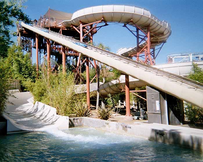
Valencia attracts millions of visitors every year to its' famous Six Flags Magic Mountain, and Hurricane Harbor.

 
See full size image


See full size imageen.wikipedia.org/wiki/Santa_Clarita,_California

www.city-data.com/city/Santa-Clarita-California.html

www.santa-clarita.com/ 

Chapter Three: Foundations of Human Activity


CANYON COUNTRY was the ancestral homeland of the Tataviam people for ovSee full size imageer five hundred years, and other tribes before then, such as the Tongva, Kitanemuk, and Serrano people.  After the Spanish invasion the valley first became grazing lands of the Mission San Fernando Rey de Espana around 1790.  In 1834, after Mexican Independence, it became part of the Rancho San Francisco land grant centered on the merging of the Santa Clara River and Castaic Creek.

In the 1880’s the rancho became the Newhall Ranch empire of Henry Newhall, now the present day Newhall Land and Farming Company.  In 1928 the St. Francis Dam collapsed, suddenly flooding and washing away settlements and people along the Santa Clara River section of present day Canyon Country.  In the 1960’s and 1970’s the Newhall Land company’s suburban developments transformed Canyon Country and its surrounding towns into a focused residential and cultural city.


VALENCIASee full size image was first planned in the 1960s by the Newhall Land and Farming Company. Development began in the 1960s and continues to the present day. Valencia is notable for its landscaped boulevards connecting a mix of apartment buildings, single-family detached homes, shopping centers, office parks and industrial warehouses.


NEWHALLSee full size image is named  after Henry Newhall, a businessman who made his original fortune during the California Gold Rush after opening up the H.M. Newhall & Company; an extremely successful auction house in San Francisco, CA. Newhall's next business interest was railroads. He invested in rail companies that would connect San Francisco to other cities and became president of the San Francisco and San Jose Railroad. In 1870, he and his partners sold the company to Southern Pacific Railroad, whose board of directors he then sat on. After railroads, Newhall turned his eye to real estate and ranching. He purchased a number of the old Spanish and Mexican land grants in the state for a total of 143,000 acres (579 km2) between Monterey and Los Angeles counties. The most significant portion was the 46,460-acre (188 km2) Rancho San Francisco in northern Los Angeles County, which he purchased for $2/acre, and which became known as Newhall Ranch after Newhall's death. Within this territory, he granted a right-of-way to Southern Pacific through what is now Newhall Pass, and he also sold them a portion of the land, upon which the company built a town they named after him: Newhall. The first station built on the line he named for his hometown, Saugus, Massachusetts. Following his death, Newhall's heirs incorporated the Newhall Land and Farming Company, which oversaw the development of the communities that now make up the city of Santa Clarita. On September 26, 1876, Charles Alexander Mentry brought in the state's first productive oil well at Mentryville, giving rise to the California oil industry. The oil was brought to a refinery at Newhall; today it is the oldest existing refinery in the world. (It was operational from 1874 to 1888.) 

SAUGUS is names after Saugus Massachusetts.  See full size imageIn 1987 Saugus and three other communities - Newhall, Canyon Country, and Valencia - were combined and incorporated, becoming the city of Santa Clarita.


DEMOGRAPHICS


Historical populations
Year
Pop.
 %±
110,642
—
151,088
36.6%
2010(est)
177,641
17.6%
source:


As of the census of 2000, there were 151,088 people, 50,787 households, and 38,242 families residing in the city. The population density was 1,219.6/km² (3,159.1/mi²). There were 52,442 housing units at an average density of 423.3/km² (1,096.5/mi²). The racial makeup of the city was 59.02% Non-Latino/Non-Hispanic White, 20.50% Hispanic or Latino of any race, 8.54% from other races 5.24% Asian, 3.89% from two or more races, 2.07% African America 0.59% Native American 0.15% Pacific Islander.


There were 50,787 households out of which 44.4% had children under the age of 18 living with them, 61.0% were married couples living together, 9.8% had a female householder with no husband present, and 24.7% were non-families. 18.7% of all households were made up of individuals and 6.1% had someone living alone who was 65 years of age or older. The average household size was 2.95 and the average family size was 3.38.


In the city the population was spread out with 30.3% under the age of 18, 8.1% from 18 to 24, 33.6% from 25 to 44, 20.8% from 45 to 64, and 7.1% who were 65 years of age or older. The median age was 33 years. For every 100 females there were 98.0 males. For every 100 females age 18 and over, there were 94.4 males.


According to a 2007 estimate, the median income for a household in the city was $79,004, and the median income for a family was $91,450 Males had a median income of $53,769 versus $36,835 for females. The per capita income for the city was $26,841. 6.4% of the population and 4.7% of families were below the poverty line 6.7% of those under the age of 18 and 5.9% of those 65 and older were living below the poverty line.


In 2000, the total population of Saugus was 41,743, and its population density was 218 persons per square mile. The median age is 32.8 years. Average number of people per household is 3.1. 66.7% of the population is married; 33.3% are single. Median Household income is $80,940; per capita income is $29,816. Median home value is $532,700. 82.4% of homes are owner-occupied; 14.8% are rentals.

www.wikipedia.org/wiki/Santa_Clarita,_California
www.santa-clarita.com/
www.city-data.com/city/Santa-Clarita-California.html

Thursday, September 16, 2010

Chapter One: Regions and Themes


Santa Clarita, California is the fourth largest city in Los Angeles County, and the twenty-sixth largest city in the State of California.  Santa Clarita was incorporated in 1987 and includes the regions of Newhall, Saugus,Valencia, and Canyon Country,   The population of Santa Clarita is estimated at 275,000.  It is located about 35 miles northwest of downtown Los Angeles, and it occupies most of the Santa Clarita Valley.  The FBI rates Santa Clarita as the sixth safest city in the United States with at least 100,000 inhabitants.  Santa Clarita was ranked number 18 of the top 100 places to live by Money magazine in 2006. 
NEWHALL
Newhall is the southernmost and oldest district of Santa Clarita, California.  It was an independent but unincorporated town.  It was the first permanent Anglo settlement in the valley.  Newhall was named after businessman Henry Newhall and it is the home to the William S. Hart County Park, featuring tours of the famous silent movie maker’s mansion.  Newhall has been the location for many movies.
                                                          
                                                         
SAUGUS

Saugus is named after Saugus, Massachusetts, the hometown of Henry Newhall, upon whose land the town was originally built.  The Saugus CafĂ©, on

San Fernando Road was established in 1887 and is among the oldest restaurants in Los Angeles County

VALENCIA

Valencia is an affluent planned community, and is located in the northwestern corner of the Santa Clarita Valley, adjacent to Interstate 5.  The estimated median household income is $109,029.00.  Six Flags Magic Mountain theme park and Hurricane Harbor Water Park are in Valencia.  


Valencia’s residential areas are separated into villages, each with its own lifestyle.  It has an extensive system of paved pathways with grade separations over and under the boulevards.  These pathways are called paseos.   These paseos connect the entire community making it possible to travel around without having to cross streets at grade.  These paseos are connected to the Santa Clara River Trail which runs east along the Santa Clara River to Canyon Country.


CANYON COUNTRY

Canyon Country is my home town and has been for the last 22 years. Canyon Country is north of the San Fernando Valley via Newhall Pass through the Santa Susana and San Gabriel Mountains.  Canyon Country is located in the upper watershed of the Santa Clara River in the Santa Clarita Valley and Sierra Pelona Mountain foothills.  Canyon Country is home to the Placerita Canyon Nature Center which is also the site of California’s original gold discovery at the historic “Oak of the Golden Dream” in 1842.